¡Ya es primavera – ven a explorar la naturaleza de Canarias! Las Islas Canarias son conocidas por su belleza natural y las muchas especies endémicas. Por supuesto, no te debes perder el Parque Nacional de la Caldera de Taburiente en La Palma, el Parque Nacional del Teide en Tenerife y el Parque Nacional de Timanfaya en Lanzarote. Pero hay muchos parques naturales más, que ofrecen hermosos paisajes aunque no son tan conocidos. ¡Hemos seleccionado cuatro para tí!
Endlich Frühling – jetzt aber auf in die Natur! Die Kanarischen Inseln sind bekannt für ihre wunderschönen Landschaften und die vielen endemischen Pflanzen- und Tierarten. Highlights sind natürlich der Naturpark Caldera de Taburiente auf La Palma, Parque Nacional del Teide auf Teneriffa und Parque Nacional de Timanfaya auf Lanzarote. Aber auch viele andere weniger bekannte Naturparks bieten spektakuläre Erlebnisse. Wir haben 4 für Sie ausgewählt!
1. PARQUE NATURAL CORONA FORESTAL, TENERIFE
Canarian pine forests and lunar landscapes
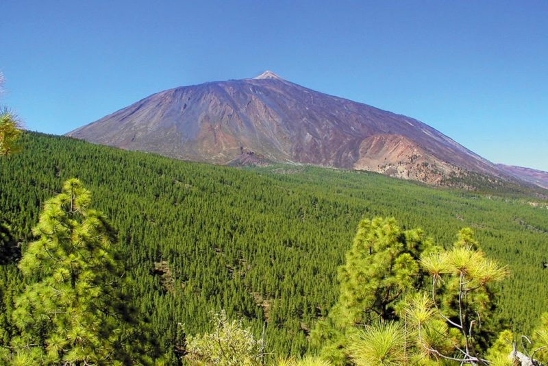
El más amplio de los espacios protegidos de Canarias cuenta con increíbles 46.000 hectáreas de bellos paisajes y bordea al famoso Parque Nacional del Teide. Aquí puedes disfrutar de amplios bosques de pino canario y si tienes suerte divisarás un pinzón azul, un pico picapinos, un escarabajo endémico, un conejo o un muflón. Escondido entre los bosques de pinos canarias, encontrarás además una espectacular formación rocosa, denominada Paisaje Lunar. En cuanto la veas, entenderás por qué ha recibido este nombre, ya que parece haber aterrizado en la Tierra desde otro planeta. Miles de años de erosión han transformado a los sedimentos de lava volcánica de color beige en una verdadera obra de arte. Es un ideal destino para una excursión. Desde el pueblo de Vilaflor tendrás que recorrer un sendero de 13 km para alcanzarlo – ¡pero sin duda vale la pena!
The largest of the protected nature areas of the Canary Islands has incredible 46,000 hectares of beautiful landscapes and borders the famous Teide National Park. Here you can enjoy wide canary pine forests and if you are lucky you will see a blue finch, a woodpecker, an endemic scarab beetle, a rabbit or a mouflon. Hidden among the pine forests of the Canary Islands, you will also find a spectacular rock formation called the Lunar Landscape (“Paisaje Lunar”). As soon as you see it, you will understand why it has received this name: it seems to have landed on Earth from another planet! Thousands of years of erosion have transformed sediments of beige volcanic lava into a stunning work of art. It is an ideal destination for an excursion – from the village of Vilaflor you will have to walk a path of 13 km to reach it – but it is totally worth the effort!
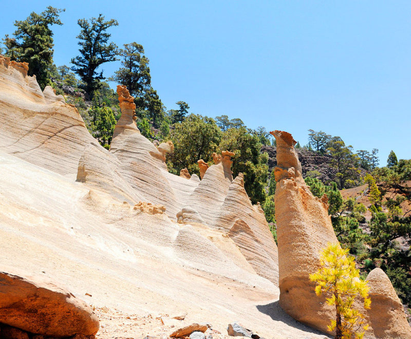
Das größte der Naturschutzgebiete der Kanarischen Inseln erstreckt sich auf unglaublichen 46.000 Hektar schönster Landschaft und grenzt an den berühmten Nationalpark des Teide. Hier gibt es viel zu entdecken: kanarische Kiefernwälder, endemische Pflanzenarten und mit etwas Glück kriegen Sie auch einige Tiere zu sehen, etwa einen blauen Finken, einen Specht, einen endemischen Skarabäus, ein Kaninchen oder ein Mufflon. Versteckt zwischen den Kiefernwäldern befindet sich auch eine spektakuläre Felsformation, die Mondlandschaft (“Paisaje Lunar”) genannt wird. Wenn Sie dort ankommen, werden Sie verstehen, warum Sie diesen Namen erhalten hat. Es scheint so als wäre diese Felslandschaft direkt von einem anderen Planeten auf die Erde transplantiert worden! Die Erosion von tausenden Jahren hat die beigen Lavaschichten in ein wahres Kunstwerk verwandelt. Es ist ein ideales Ziel für einen Tagesausflug – vom Dorf Vilaflor aus müssen Sie eine Strecke von 13 km zurücklegen – aber es lohnt sich garantiert!
2. PARQUE NATURAL DE LAS NIEVES, LA PALMA
A lush green laurel forest full of natural wonders
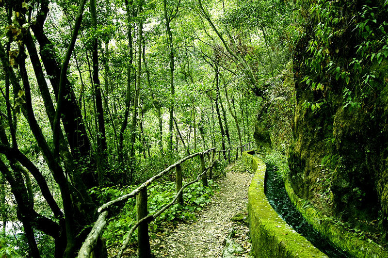
La isla de La Palma es conocida por ser la isla más verde de las Islas Canarias y el Parque Natural de las Nieves es uno de los puntos con vegetación más exuberante de la isla. Se encuentra en los municipios de Santa Cruz de La Palma, Puntallana y San Andrés y Sauces en el noroeste de la isla y cuenta con una superficie de 5.094 hectáreas. En su núcleo se encuentra el Bosque de los Tilos, una hermosa muestra del bosque de laurisilvas lleno de enormes helechos, musgos, plantas endémicas de canarias y algunas especies animales tan especiales, como la paloma de laurisilva, que se encuentra en peligro de extinción. Uno de los senderos más bonitos para explorar la hermosa zona de laurisilva es el Cubo de la Galga, un recorrido de 12 kilómetros (4 horas), cuya baja dificultad permite llevar a niños y personas mayores. Si quieres relajarte en medio de la naturaleza, puedes escoger uno de los numerosos merenderos para hacer un picnic. También hay una cafetería y un Centro de Visitantes, donde puedes aprender más sobre la naturaleza de La Palma.
The island of La Palma is known for being the greenest island of the Canary Islands and the Natural Park of Las Nieves has the most lush vegetation of the island. It is located in the municipalities of Santa Cruz de La Palma, Puntallana and San Andrés y Sauces in the northwest of the island and spans an area of 5,094 hectares. At its core is the Tilos Forest, a beautiful example of the laurel forest, full of huge ferns, mosses, endemic Canarian plants and special animal species, like the laurisilva pigeon, which is in danger of extinction. One of the most beautiful paths to explore the laurel forest is the trekking route Cubo de la Galga, a journey of 12 kilometers (4 hours). The difficulty is low, so it is perfect to take kids and older family members. If you want to relax in the middle of nature, you can choose one of the many picnic spots. There is also a cafeteria and a Visitors Center where you can learn more about the nature of La Palma.
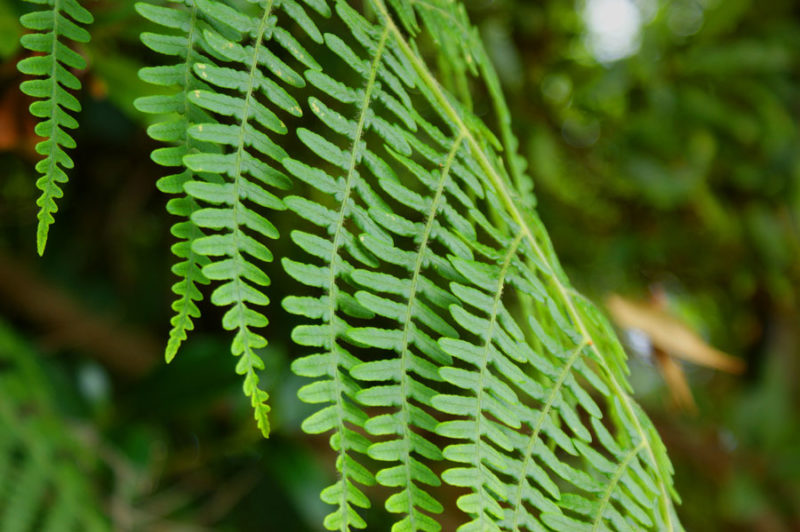
La Palma ist als die grünste Insel der Kanaren bekannt und der Naturpark de las Nieves ist sozusagen das grüne Herz der Inseln – hier befindet sich die üppigste Vegetation der Insel. Der Naturpark befindet sich in den Gemeinden von Santa Cruz de La Palma, Puntallana und San Andrés y Sauces im Nordwesten der Insel und erstreckt sich über eine Fläche von 5.094 Hektar. Im Kern des Naturparks liegt der Wald Bosque de los Tilos, ein Lorbeerwald voller riesiger Farne, Moos, endemische Pflanzen der Kanarischen Inseln und einige besondere Tierarten, wie die Taube des Lorbeerwaldes (paloma de laurisilva), die vom Aussterben bedroht ist. Einer der schönsten Wanderwege um den Lorbeerwald zu erkunden ist der Wanderweg Cubo de la Galga, eine 12-km-lange-Strecke (4 Stunden). Der geringe Schwierigkeitsgrad erlaubt es die ganze Familie mit auf den Ausflug zu nehmen. Wenn Sie sich inmitten der Natur entspannen möchten, können Sie es sich an einem der vielen Picknickplätze gemütlich machen. Es gibt auch ein Café und ein Besucherzentrum, in dem Sie mehr über die Natur von La Palma lernen können.
3. PARQUE NATURAL TAMADABA, GRAN CANARIA
Green forests, steep cliffs and a dragon tail
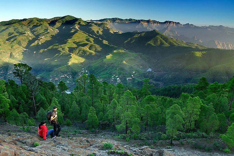
Este parque natural de 7.500 hectáreas se encuentra en el noroeste de la isla de Gran Canaria y se caracteriza por su increíble variedad de paisajes. Hay una amplia zona de monte con un frondoso bosque de pinos canarios, barrancos llenos de zonas de cardonales, tabaibales y fascinantes plantas endémicas y acantilados escarpados, que ofrecen una vistas magníficas al Atlántico. Para llegar a la hermosa zona de bosques hay que seguir la carretera GC-216 desde Artenara durante unos 20 minutos. Una vez llegado a lo alto puedes hacer un picnic en el área recreativa y ascender al Pico de la Bandera (1.444 metros) para disfrutar de unas vistas excelentes. En los riscos de la zona costera nidan muchas especies de pájaros, que puedes observar, por ejemplo desde el Mirador del Balcón. Hay que destacar también el acantilado Roque Faneque, que con sus 1.008 metros de altura hace frente a la embestida de las olas del Atlántico. Recomendamos también descender hasta Agaete para observa La Cola del Dragón: una cadena de acantilados en zig zag que desde la costa se parecen a la cola de un monstruo de leyendas antigua.
This natural park of 7,500 hectares is located in the northwest of the island of Gran Canaria and is characterized by its incredible variety of landscapes. There is a large mountain area with lush Canary pine forest, ravines full of cactus, palm trees and fascinating endemic plants and steep cliffs, which offer a magnificent view of the Atlantic. To get to the beautiful forest area you have to follow the GC-216 road from Artenara for about 20 minutes. Once you reach the forest area you can have a picnic in the recreational area and ascend to Pico de la Bandera (1,444 meters) to enjoy excellent views. The many bird species that nest in the cliffs of the coastal area, can be observed, for example, from the viewpoint Mirador del Balcón. It is also worth mentioning the cliff Roque Faneque, which with its 1,008 meters of height bravely faces the continuos battle against the waves of the Atlantic. We also recommend descending to Agaete to observe The Dragon’s Tail: a chain of zig zag cliffs that when viewed from the coast resembles the tail of a monster from ancient legends.
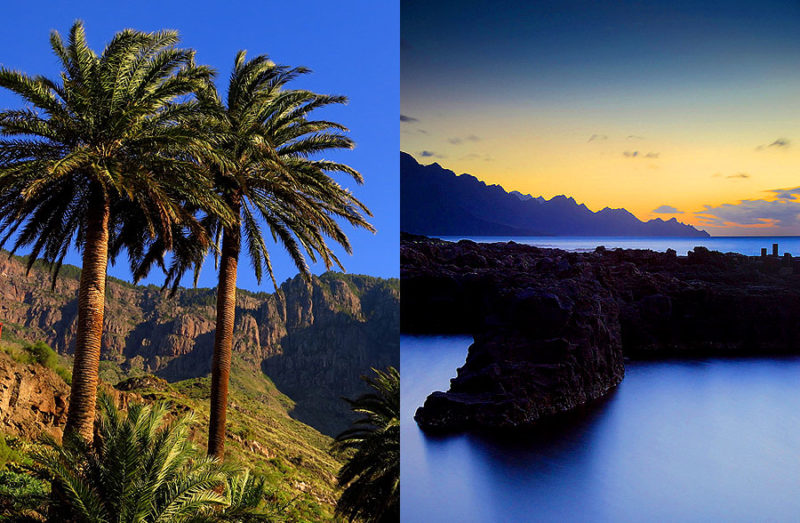
Dieser Naturpark umfasst 7.500 Hektar Land und liegt im Nordwesten der Insel Gran Canaria. Bezeichnend ist die unglaubliche landschaftliche Vielfalt: üppige Pinienwälder, Schluchten voller Kakteen, Palmen und anderen faszinierenden endemischen Pflanzen und steile Klippen, die einen herrlichen Blick auf den Atlantik bieten. Um das schöne Waldgebiet zu erreichen muss man der Straße GC-216 von Artenara aus etwa 20 Minuten lang folgen. Einmal angekommen, können Sie sich erstmal beim Picknick entspannen und den Pico de la Bandera (1444 m) besteigen um die hervorragende Aussicht zu genießen. Auch die Küstenregion hat viel zu bieten. In den Felsen am Meer nisten viele Vogelarten, die Sie z.B. vom Aussichtspunkt Mirador del Balcón aus beobachten können. Auch erwähnenswert ist die Klippe Roque Faneque, die sich mit ihren 1.008 Metern Höhe stolz dem unermüdlichen Angriff der Wellen des Atlantik entgegenstellt. Auch ein Besuch der Küste von Agaete ist zu empfehlen um von hier aus den sogenannten Drachenschwanz zu beobachten: von hier aus gesehen bilden die Klippen eine Zickzacklinie, die (jedenfalls mit etwas Fantasie!) auch als Drachenschwanz durchgehen könnte.
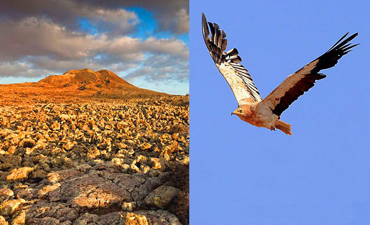
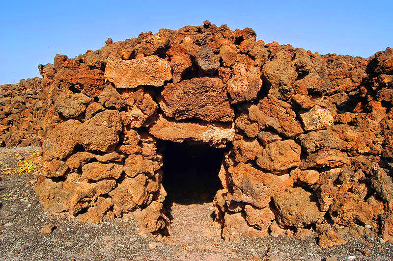
4. PAISAJE PROTEGIDO DE MALPAÍS GRANDE, FUERTEVENTURA
The land of black lava, arid lanscapes and a bird of prey
